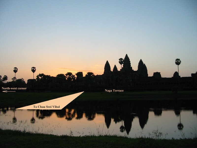

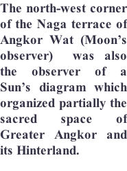
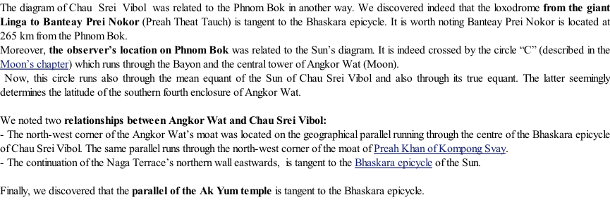
Rising Sun on Angkor Wat
Courtesy of Moyra Farrington
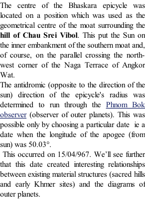


The frame of the main hydraulic works

Copyright Robert Bywater & Jean-
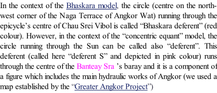
Preah Khan of Kompong Svay
It is worth noting that, In 1018, Suryavarman I consecrated three Linga to delimit his kingdom. They were located in:
-
-
-
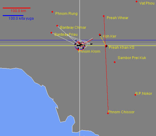
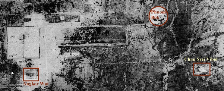
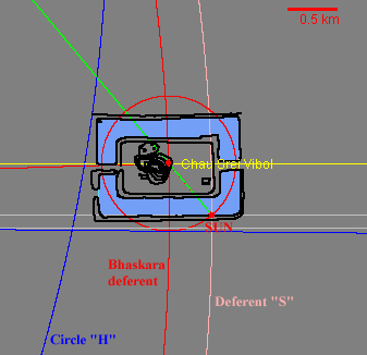
Suryavarman built also the monuments of Chau Srei Vibol and the city of Preah Khan KS.
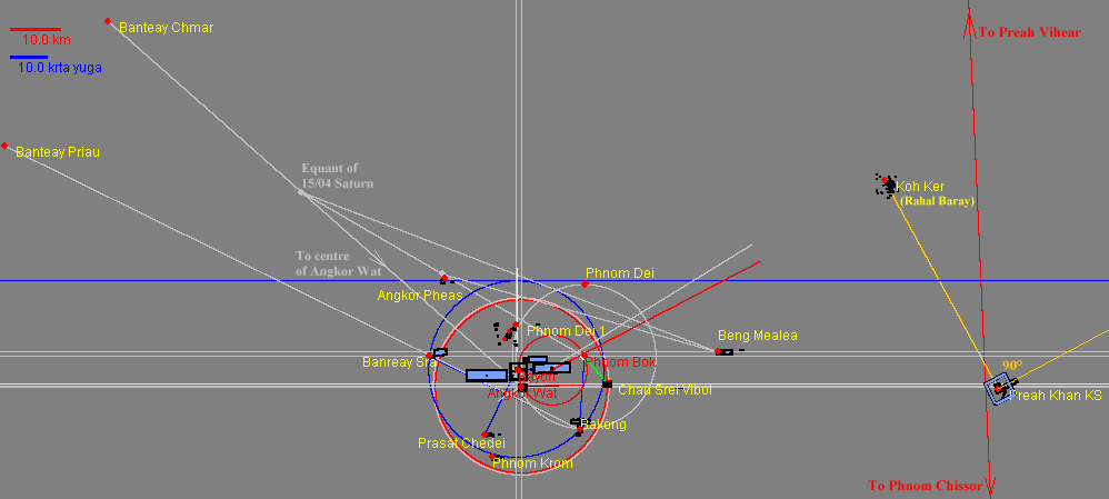
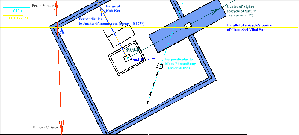
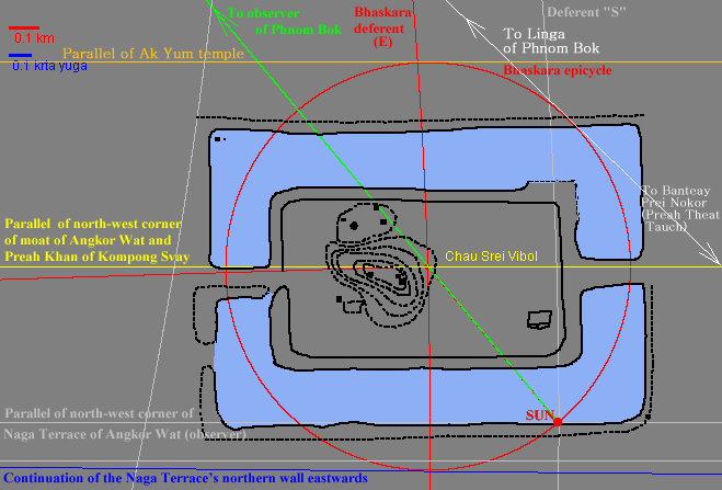
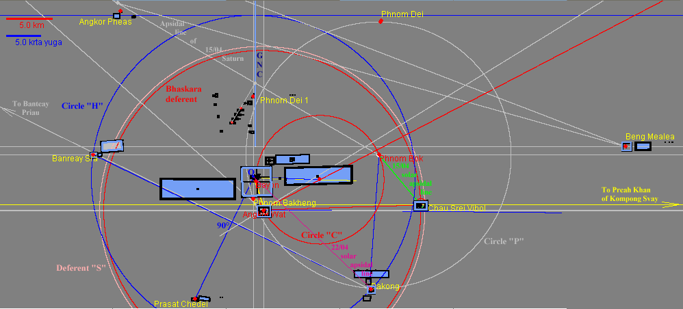
Now, we have established that the north west corner of Preah Khan KS 's moat was located on the intersection of the parallel of the epicycle's centre of the Chau Srei Vibol Sun with the loxodrome from Phnom Chisor to Preah Vihear.
This relationship between history and geometry is remarkable.
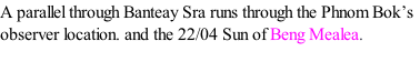
A figure related to the zenith culmination of 15/04/967 (Julian calendar)
We have seen in the previous chapter there is a relationship between the Sun’s diagram and the site of Phnom Chissor, a sacred hill situated 267 km to the south-
Note: It is worth remembering we use the Julian calendar to obey the usual convention of the historians although the Gregorian calendar, which does not shift with respect to the seasons, would be more practical in an astronomical context.
The toponymy confirms our hypothesis : the Khmer name for Phnom Chissor was “Suryaparvata” ie “Mountain of Surya”. Now, Surya was the Sun God.
We’ll see in the chapter on the 15/04 outer planets of the hinterland that the complex of Preah Khan of Kompong Svay was conceived as a hub. The intersection of the parallel of the centre of the Chau Srei Vibol Sun’s epicycle with the loxodrome from Phnom Chissor to Preah Vihear is one component of the hub. Another creates a relationship with the site of Koh Ker (an earlier hub) which was located on the parallel where the zenith culmination occurred (and still occurs) on 27/04 (Gregorian), a date which corresponds to 22/04 Julian during the year 967 ie the reference date of the earlier planetary diagrams.
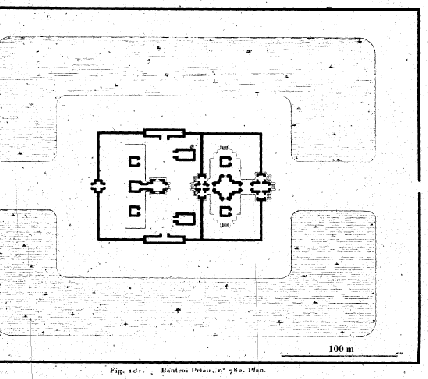
BANTEAY PRIAU
Lunet de La Joncquière -