


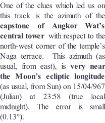
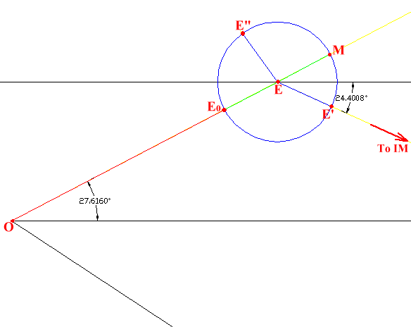
The corresponding celestial configuration
Coordinates of observer (north-
13.413658°
103.864975°
Coordinates of alleged Moon:
13.412474 °
103.866818 °
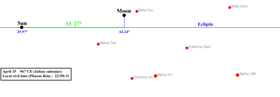
Azimuth of alleged Moon (as seen from observer) = 33.270 °
Distance from observer = 238.695 m
The Moon would be located directly below the capstone of central tower, 0.54 m to the south west of tower’s centre
(0.44 m to south and 0.32 m to west)
Angular error = 0.13°
Heavenly dancing girl (« Apsara »)
Courtesy of Moyra Farrington

Mean equant (centre of evection epicycle):
Coordinates 13.413768 ° N ; 103.865189 ° E
Distance from observer = 26.148 m (15.012 phyeam)
Azimuth (as seen from observer) = -
Centre of “C”:
Coordinates:13.443063° N ; 103.9227988° E
Azimuth (as seen from observer) = -
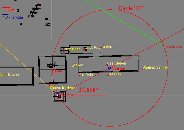
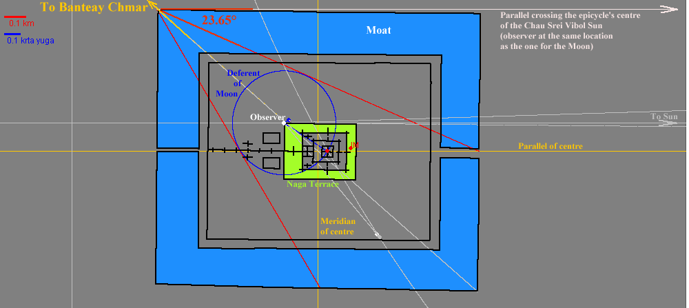
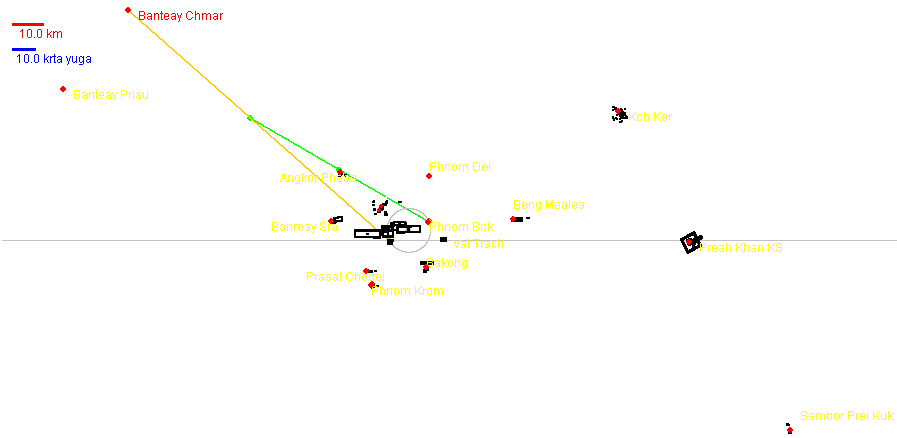
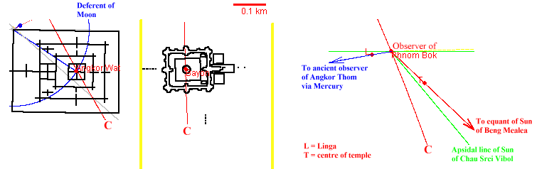
Precise trajectory of circle « C » through Angkor Wat, Bayon and Phnom Bok
The « ancient observer of Angkor Thom » is the observer for the 22/04/967 inner planets and Sun of the Eastern Baray
LINKS : Bayon as observer, observer of Phnom Bok, Sun of Chau Srei Vibol, Sun of Beng Mealea


The distance between the centre of the circle and the centre of the central tower of Angkor Wat is 6942.6 m.
Now, 10 * 54 * 29.530589 cubits = 6943.91 m
With:
29.530589 days = synodic period of Moon and 1 cubit = 0.43545 m.
As Angkor Wat is a lunar temple with many sets of 54 gods and as the Khmers used the decimal system beside the sexagesimal one, we think this distance is interesting.
Copyright Robert Bywater & Jean-
x = -
Download : approx. 45 seconds with broadband connection and « Safari » browser
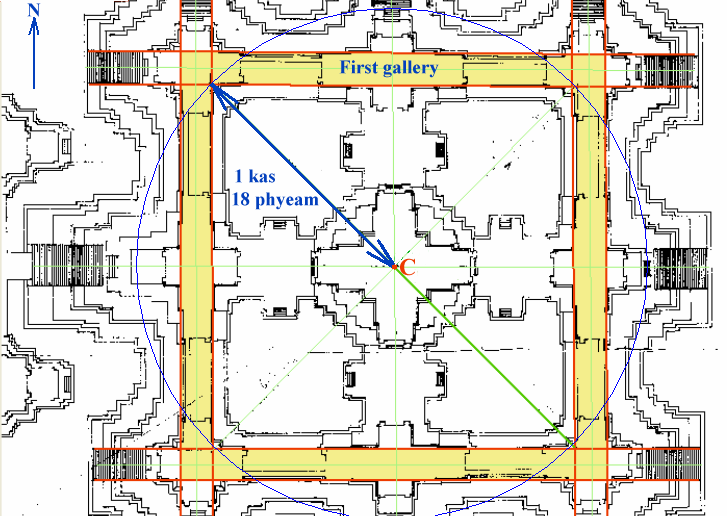
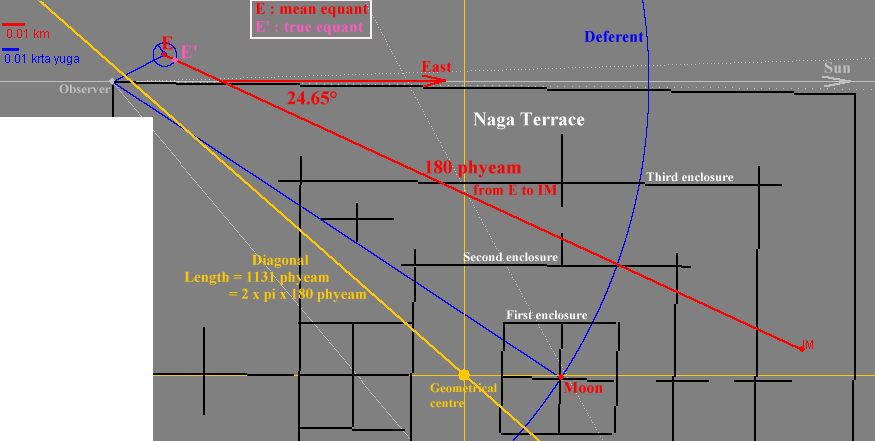
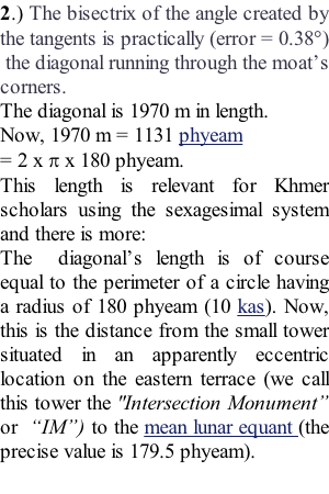
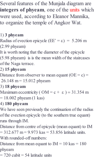
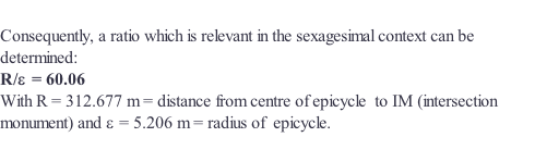
The maximum eccentricity ( c + = 18 phyeam ) is related to the dimensions of the first gallery :
A circle having a radius of 18 phyeam and whose centre is the capstone’s finial ( C ) runs indeed through the inner corners of this gallery.
There is perhaps a numerical relationship between the latter radius and the height of the central structure: according to Eleanaor Mannika, there is indeed a height of 54 cubits from the roof of the central sanctuary to the top of the tower’s finial. The same height has been measured by the latter scholar from the sacred deposit to the floor level of the central sanctuary.
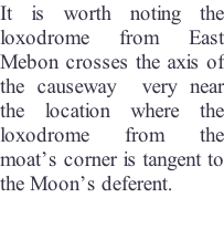
Two loxodromes cross the mean lunar apsidal line on the centre of the circle « C »
-
-
to the centre of the Banteay Samre temple.
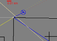
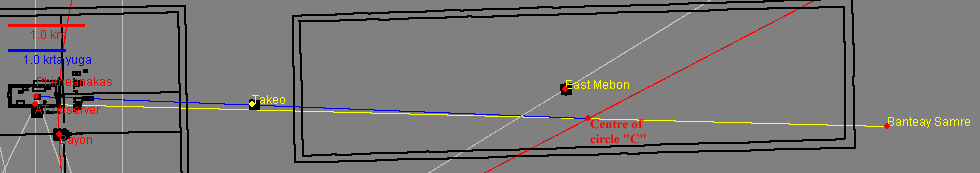
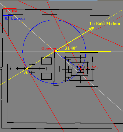
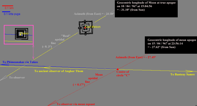
The Munjala lunar model was designed to calculate the equation of centre and its correction but it can’t provide the real longitude of the “true” equant. It is nevertheless possible this longitude was actually observed. The intersection ( A ) of the deferent with the causeway is located on the loxodrome from the East Mebon to the observer.
Now, the azimuth of this loxodrome (31.40° north of east) indicates possibly the location of the Moon (31.10° from Sun) when it crossed its true (real) apogee on 10 / 04 / 967, five days before the date of reference.
Corresponding JAVA APPLET x = -
Download : approx. 45 seconds with broadband connection and « Safari » browser